
Geocachers Gather at Saginaw Basin Land Conservancy Sand Point Reserve
September 12, 2009
1 Comments
|
||||||||||||||||
| Printer Friendly Story View |
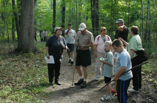
The Saginaw Basin Land Conservancy (SBLC) held it's first Geocaching event at the new Sand Point Nature Preserve on Saturday, September 12. The event was attended by about 25 people. Some were experienced Geocachers, some were new to the sport and some, like your reporter had no idea what to expect.
The 139 acre Sand Point Preserve is one of the newest additions to the SBLC properties. The preserve runs from M-25 to the Bay. The formerly private land has several dirt roads which are not open to vehicles but make great walking paths through a beautiful forest with abundant wildlife.
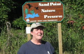
Organizer Darlene Elias aka "Windrose"
 Saturday's event was announced on the Michigan Geocaching Organization (MiGO) web site. MiGO, founded in 2002, is one of the oldest such organizations in the country. It promotes the sport of Geocaching in Michigan and provides information to the public about the sport of geocaching. The organization's web site,
Mi-Geocaching.org provides a wealth of information.
Saturday's event was announced on the Michigan Geocaching Organization (MiGO) web site. MiGO, founded in 2002, is one of the oldest such organizations in the country. It promotes the sport of Geocaching in Michigan and provides information to the public about the sport of geocaching. The organization's web site,
Mi-Geocaching.org provides a wealth of information.
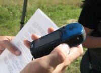
The concept of geocaching is a modern update of hide and go seek. Someone hides a cache of objects then provided the GPS coordinate to the location and some clues. Other people use their GPS device to locate the general area then use the clues to find the cache.
A cache is typically a simple container. The most popular are plastic containers, jars and cans. The clues give you an idea what to look for and the level of difficulty. The more devious caches are called nanoscale or "nanos" and can be the size of a thimble.
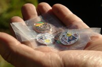
Path Tags
Saturday's event was a search for temporary caches that were hidden specifically for the day. Many locations have permanent caches that are registered with one of the Internet services like GeoCaching.com where finders can log their name and thus keep score. The site catalogs almost 900,000 geocaches. Visit the site to find a cache near you! The path tags can be purchased and logged at pathtags.com.
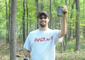
Brock "KC8KOD" - first find of day.
Geocaching is not an exact science. GPS devices can locate a point to within about 20 feet. The satellite signals are affected by atmospheric conditions, terrain, and obstructions, even trees. According to SaginawMike, a 2 year geocacher, "You get close then use the clues and your experience to find the cache. That's the fun and it's where your skill comes in."
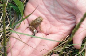
Cute frog, but not on the cache list
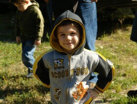
Cameron: Ready to hit the trail
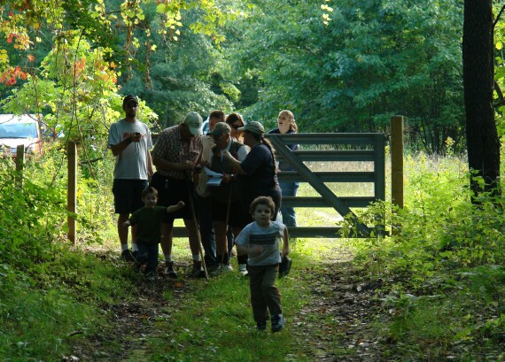
Someone seems to know where he's going already!
View Larger Map
The Saginaw Basin Land Conservancy helps maintain the quality of life in the Saginaw Bay Watershed through the preservation of important wetlands, waterways and land of all types. The Conservancy is a non-profit charitable organization working in the Saginaw Basin. To date, the Conservancy has permanently preserved more than 5,000 acres in the watershed.
| Printer Friendly Story View |
|
|
Prior Article
March 5, 2025 by: Stephen Kent St. Patricks Parade 2025 - IT's TIME |

|
Next Article
February 10, 2020 by: Rachel Reh Family Winter Fun Fest is BACC Hot Spot for 2/10/2020 |
"The BUZZ" - Read Feedback From Readers! |
|
makowski.mike Says:
On September 14, 2009
at 12:57 PM
Internet services like pathtags.com where finders can log their name and thus keep score.
Should read: Internet services like geocaching.com where finders can log their name and thus keep score. pathtags.com is for logging the little token coins only. Thanks! Mike |
|
|

Stephen Kent |
|
|
|
Printer-Friendly Story View
0200 Nd: 04-30-2025 d 4 cpr 0
12/31/2020 P3v3-0200-Ad.cfm
SPONSORED LINKS
12/31/2020 drop ads P3v3-0200-Ad.cfm