Punxsutawney Weather Prognosticator Says Spring Is Coming Early
Furry Phil Doesn't See Shadow, Meets Bill Murray, Predicts Early Spring
February 4, 2007
By: O. J. Cunningham
Punxsutawney Groundhog named 'Phil' does NOT see his shadow -- 'Phil' says it will be an early Spring.
REALITY CHECK: Local weather forecast calls for sub freezing temperatures until Valentine's Day
I watched "Groundhog Day" (The Movie) three times this weekend.
WHY? 'Cuz it was too darned cold to leave the house.
According to every weather forecaster on the planet, the sub-freezing weather is here to stay for the next seven to ten days.
Here's The Ten-Day Forecast.
But there was also some good weather news on Friday. Punxsutawney Phil
did not see his shadow in Pennsylvania.
According to traditional weather lore, if a groundhog named Punxsutawney Phil, living in Punxsutawney, Pennsylvania, emerges from his burrow on the morning of February 2nd and fails to see its shadow (because the weather is cloudy), Spring is just around the corner.
If Phil sees its shadow because the weather is bright and clear, furry Phil supposedly is frightened and runs back into its hole, and Winter will continue for six more weeks.
I've never been very fond of Punxsutawney Phil. (
Read my column from 2005).
It's somewhat unusual for Phil not to see his shadow. This is the first time since 1999 that Phil has not seen his shadow. And, it's only the 15th time in all of history that Phil has predicted an early end to Winter.
By the way, six weeks = Friday March 16th, 2007. This bodes well for the St. Patrick's Day Parade which is scheduled for Sunday March 18th.
Since we're going to a few bad days of cold and wind chill, I compiled a list of common "Winter Warning" type words that you should probably get familiar with.
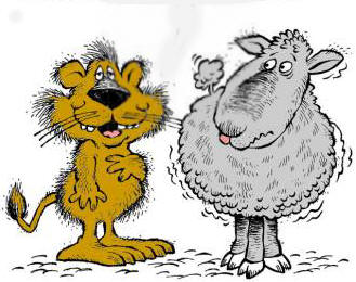
After all, it's just a few weeks to March 1st. And you know what they always say: "In like a Lion . . . Out like a Lamb."
Here's the word list!
Winter Storm Watch - Hazardous winter weather conditions including significant accumulations of snow and/or freezing rain and/or sleet are possible generally within 36 hours. These watches are issued by the Weather Service Forecast Office.
Winter Storm Warning - Hazardous winter weather conditions that pose a threat to life and/or property are occurring, imminent, or highly likely. The generic term, winter storm warning, is used for a combination of two or more of the following winter weather events; heavy snow, freezing rain, sleet and strong winds.
Blizzard Watch - Sustained winds or frequent gusts of 35 mph (56 km/h) or greater, considerable falling and/or blowing snow reducing visibility frequently to 1/4 mile (0.4 km) or less for a period of three hours or more are possible generally within the next 36 hours.
The following event-specific warnings are issued for a single weather hazard:
Blizzard Warning - Sustained winds or frequent gusts of 35 mph (56 km/h) or greater, considerable falling and/or blowing snow reducing visibility frequently to 1/4 mile (0.4 km) or less for a period of three hours or more. There are no temperature criteria in the definition of a blizzard but freezing temperatures and 35 mph winds will create sub-zero wind chills.
Heavy Snow Warning - Heavy snowfall amounts are imminent and the criteria for amounts varies significantly over different county warning areas.
Lake Effect Snow Warning - Heavy lake-effect snowfall amounts of generally 6 inches in 12 hours or less or 8 inches in 24 hours or less are imminent or highly likely. Lake-effect snow squalls can significantly reduce visibilities with little notice.
Ice Storm Warning - Heavy ice accumulations are imminent and the criteria for amounts varies over different county warning areas. Accumulations range from 1/4 to 1/2 inch or more of freezing rain. In Canada, these are known as Freezing Rain Warnings.
Sleet Warning - Heavy sleet accumulations of 2 inches or more in 12 hours or less are imminent.
Winter Weather Advisory - Hazardous winter weather conditions are occurring, imminent or likely. Conditions will cause a significant inconvenience and if caution is not exercised, and may result in a potential threat to life and/or property. The generic term, winter weather advisory, is used for a combination of two or more of the following events; snow, freezing rain or freezing drizzle, sleet, blowing snow.
The following event-specific advisories are issued for these single weather hazards:
Snow Advisory - Moderate snowfall amounts are imminent and the criteria for amounts varies significantly over different county warning areas. They can range from as little as one inch in Florida to up to half a foot out West.
Freezing Rain Advisory - A trace to 1/4 inch of freezing rain is expected is needed in any county warning area to prompt a freezing rain advisory.
Snow and Blowing Snow Advisory - Sustained winds or frequent gusts of 25 to 35 mph (40 to 56 km/h) accompanied by falling and blowing snow, occasionally reducing visibility to 1/4 mile (0.4 km) or less.
Blowing Snow Advisory - Widespread blowing snow with winds 25 to 35 mph (40 to 56 km/h), occasionally reducing visibility to 1/4 mile (400 m) or less.